Friday, July 16, 2010

Blackhawk Trail

This is a new sign installation for the Loafer Mountain trail, which leads to the Bennie Creek trail. This sticker format is our standard for marking trails.

We stopped to say "Hi" to the Dispersed Recreation crew. They were improving a post & rail fence around the Payson Lakes Guard Station. These folks do some good work and are a fun group to be around.

Purple Salsify or Oysterplant- Tragopogon porrifloius. This pretty thing is a weed from Western Europe. Supposedly the roots taste like oysters...

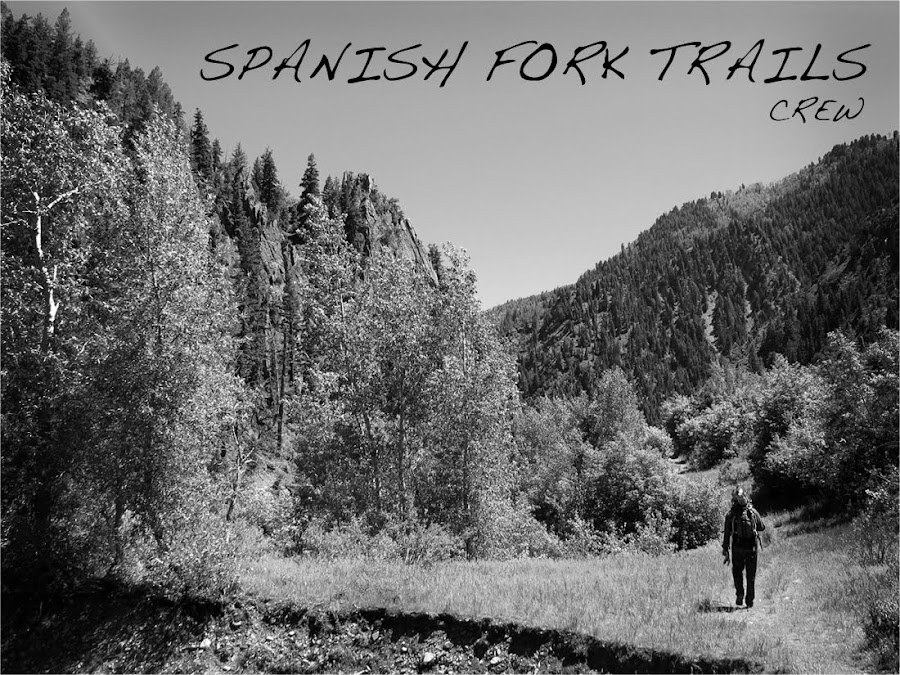
Here is Adam as we work our way South on the Blackhawk trail. We were in search of a half dozen Aspens that had reportedly come down across the trail.

Oregon checkermallow- Sidalcea oregana. Native species in the cotton and hibiscus family.

Monkey flower- Mimulus gattatus. Native commonly found along rushing streams.

False hellobore- Veratrum californicum. This plant is being researched for anti-tumor properties. It is poisonous to cattle.

False Dandelion or Orange Agoseris- Agoseris aurantiaca. Native.

Adam looks things over once more before cutting this Quakie off the trail.

Here is some Columbine with a violet tinge.

Looking at our plant ID sheet on the Payson Lakes Guard Station porch.

Richardson's Geranium- Geranium richardsonii. This white geranium is associated with wet areas and streamsides.

We found this stuff growing amongst the Mules Ear on the Blackhawk trail. It feels just like the stuff you find when shucking corn apart. It is commonly known as Dodder and is in the Cuscuta genus.

Adam hiking through a massive field of Mules Ear on Blackhawk trail.

We joined the Rec Crew for a weenie roast at lunch.

And of couse, S'mores.

Thanks to Teresa, our super knowledgeable Forest Service Regional Botanist. She is our primary source to ID our plant photos and we have yet to stump her.

Tuesday, July 13, 2010

Loafer Mountain & Santaquin Peak

Adam atop Loafer Mountain on Santaquin Peak @ 10,685 ft. 20 percent chance of T-Storms?...and we were certainly keeping an eye on the sky.

Nate atop Santaquin Peak. After hiking through the heat all morning and saturating my clothes with sweat, things got breezy and cool on top. Today happened to be the first day I wore cotton all season.

The mail box. These are found on several peaks along the Wasatch. The skull appears to be from a mountain goat.

Just in case you were worried the final few feet were too easy and too flat...

The view to the South, looking at Mount Nebo. Payson Lakes can also be seen just above the ridge line to the left.

We saw some goats...3 adults and 2 kids. We heard them first, as is usually the case for me. Are goats native? I say no, but according to the DWR, it's arguable.

Looking North from just below the summit. Spanish Fork Peak and Provo Peak are visible in the distance.

Not a great photo, I know. But this is SNOW! I got the winter bug a little too early this season.

What's with all the dead stuff? Some trees that have been killed by beetles turn red when they die. These trees are no longer red because they have been dead for years and have lost off of the red needles.

Same scene as the previous photo, only zoomed out a little.

This was a moment of realizing that I still had a good way to go.

Adam yields the pole saw. We put this tool to seriously good use almost every day. Horsemen...you can thank us when you see us. This tool is basically for your benefit.

See Adam in the top right?

An AMAZING day of fragrant wild flowers. This was the most floral trail I have been on in a while.

Personally, I don't think Adam looks as tired as he should here. The pole saw also doubles as a great machete, which Adam is using it for here.

Total miles for the day? Approx. 12. Not too shabby. We started at about 9am, worked our way up the trail reaching the summit at 1:30pm. We were back at the truck at 3:30pm. Only 1 hiker was encountered. Talk about a mountain that doesn't have the same traffic as Timp!

Wednesday, July 7, 2010

June

Adam removes this large White Fir from the Right Fork Salt Creek trail.


These cliffs are on the bottom portion of the Right Fork Salt Creek trail.


Adam and Billy crossing Salt Creek


Adam cut this old Quakie off of the Blackhawk trail south of Bear Trap Ridge.


This cluster of dead Aspens was on the Blackhawk trail also. These trees were leaning over the trail and so we decided to bring them to the ground. Several trees had already come down on their own.


This was the scene once the trees were safely on the ground.


Adam cuts the stump after this falling this hazard tree.


This photo was taken on the Maple Canyon trail. We worked on limbing low hanging branches for horseman as well as cutting back those trees and bushes that were intruding into the trail. This pole saw is fully extended and this is perhaps the highest cut I've seen yet.


This Vase Flower was seen on the Nebo Bench trail.